
The “Fire Management and Advanced Analytics” group of the Complex Engineering Systems Institute (ISCI) has taken on the challenge of developing optimization models and simulators with Machine Learning, capable of predicting where a fire is most likely to begin and where it will spread to determine concrete action that can reduce the loss of human and animal lives, as well as the economic impact, and pollution caused by carbon emissions.
While a number of very good simulators for the combat stage of a fire, which help fire brigades to decide where to locate their resources and how to evacuate the population once the event has started, little research exists on how to prevent them from happening in the first place, making these tools pioneers in the world.
Context:
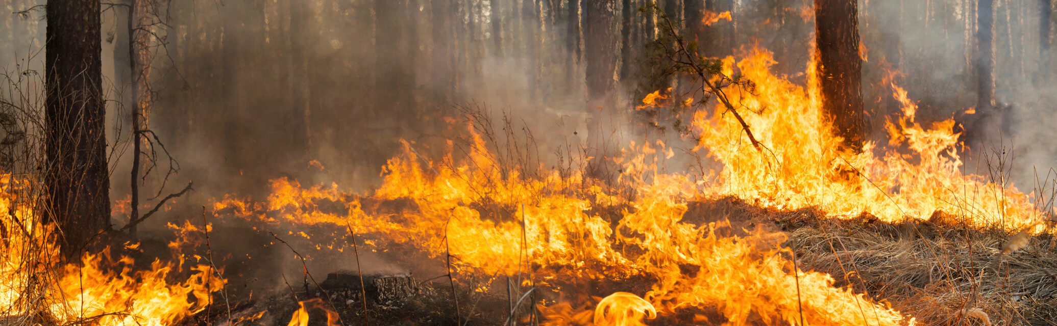
Statistics show that there has been a considerable increase in the number of hectares affected by forest fires over the last decade in Chile.
What explains this increase?
The most relevant factor is climate change and the megadrought. It was previously thought that with temperatures over 30º Celsius, air humidity below 30%, and wind speeds over 30 kilometers per hour, the risk of fire increased significantly. However, the magnitude of such an event was controllable.
We have seen a change in these figures today, due to both the anthropogenic effect and natural climate variability. In the summer of 2022/2023, more than 426,000 hectares were consumed and fires were detected in places with temperatures over 40º Celsius, wind speeds of 70 km/hour, and less than 20% ambient humidity. In these cases, the intensity of the events reached levels that were difficult to control. The flames rose to the tops of the trees with sparks extending over several kilometers, spreading the fire at high speed. Climatologists believe that these adverse conditions will be increasingly commonplace in Chile.
How can analytics and sophisticated tools support the fight against these events?
Operations Research can contribute to the three stages of a forest fire:
- Prevention: Evaluating how vegetation is managed with the aim of achieving a landscape more resistant to the effects of a fire.
- Combating the incident: Determining how the fire will behave and thus responding to the emergency optimally with the available resources.
- Restoration: Planning the reconstruction of houses, reforestation and even addressing the social and psychological effects on the population.
While many studies exist on the characteristics of soils and the behavior of fire in them, integrating Operations Research tools to confront these phenomena is highly innovative. ISCI decided the way ahead was to concentrate their efforts on the fire prevention stage.
Within the framework of the FONDEF project “Design of landscapes resistant to forest fires integrating simulation models, optimization and Artificial Intelligence”, between 2021 and 2023, an ignition prediction model was developed by the Fire Management and Advanced Analytics group led by researcher Andrés Weintraub in collaboration with the National Corporation Forestry (CONAF) and the National Emergency Office (ONEMI).
“In order to train the model and validate it, we relied on historical ignition data from 1,000 forest fires in the central zone of Chile. We divided the territory into cells of one hundred by one hundred meters. What we wanted to find out was the probability of a fire starting in each of these cells. In the calculation, we considered historical data and risk factors such as forest plantations, populated areas, and areas adjacent to a road, to which we assign a “weight” or incidence level using Machine Learning. We then took the information from 700 fires and asked the model to indicate the ignition point of the remaining 300 to validate it. We managed to predict 90% of them, which is a good result,”
explains Andrés Weintraub.
Once the tool was validated, the group adapted its own simulation model – called Cell2Fire – specifically for the case of Chile, which they had previously designed together with researchers from the United States and Canada for forest fires in the latter country.
“Cell2Fire is a simulation model that predicts in which direction the fire will spread based on the ignition point. Since this is a problem of high uncertainty, multiple simulations must be carried out. The results show which places are most likely to burn. In the FONDEF project, we integrated large volumes of new data into the model, specific to Chile, such as climate projections for the next summer season, historical ignition point data, information on the type of vegetation found in each of the cells, obtained from a CONAF inventory called Kitral, satellite information, and information from aerial images, as well as risk factors. We managed to make it possible for this flexible fire simulator to integrate the behavior of fire in different areas with a model of preventive decisions that specifically considers the reality in Chile. Part of the complexity of the model is that it handles large volumes of data, which can change quickly from year to year,”
adds the researcher.
It is thanks to this development that we can determine the “path of fire” of previous events and, therefore, where there is a greater probability of this reoccurring. From this information, we can make medium-term decisions and prepare the population for the next summer season, determine strategic points to make firebreaks that slow the advance of the flames, identify where land must be cleared to reduce the load of fuel, or where trees should be pruned so the fire does not rise to the top so easily.
The next step was to carry out 1,000 simulations randomly, considering a temperature, an ignition point and a speed of fire advance from one cell to another, determined by the characteristics of the materials in the soil. With these 1,000 simulations, a map can be created, on which darker areas identify those places with a greater burn probability.
In a second stage, the researchers are working on a new mixed-optimization model called Downstream Protection Value, which evaluates what happens if one of the cells is intervened by cutting down trees or changing the fuel load, predicting the impact in the cells around it. The model allows us to determine which cells provide the greatest protection for inhabitants, economic interests, biodiversity, and carbon emissions into the atmosphere.
Collaboration with FIRE-RES
Recently, the Fire Management and Advanced Analytics group, together with collaborators from CONAF and CORMA, were invited to take part in FIRE-RES, a research project that included 30 teams from European Union nations with vast experience in prevention, combat, and fire restoration.
“The fact that they have chosen to invite a group from Chile to participate in FIRE-RES speaks highly of us and the level of research being carried out here. It shows we are capable of competing globally on the frontier of knowledge. Together, we collaborate with the commitment to install these pioneering systems in Catalonia, Portugal, and the Canary Islands,”
explains Andrés.
Medium-term challenges
At present, the group is in the application process for a second FONDEF project to continue development. One of the pending tasks is to add more data to simulate crown fire, since the current system does not integrate that information.
Another challenge is to translate these results into public policies, implementing concrete prevention measures in the summer of 2025 in the regions of Valparaíso, Maule, and Bío Bío, based on the results of the simulations.
Finally, to enhance its impact, the team is developing ways to “package” the open-source tool to make it is more user-friendly for different institutions in Chile and other nations around the world.
Comunicaciones ISCI